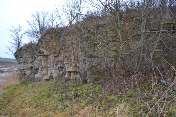
Hill of Skaliai
Hill of Skaliai
This hill is the village of Stipinai, Joniškėlis eldership, on the right bank of the River Mūša. Its steep slope sharply goes into the river; but it gradually descends into the valley in the east and in the west there is a slope of several hundred meters long and 7 meters high, overgrown with grass and bushes. It is a dolomite (also called dolomite rock, lime, limestone, limestone or scale) rock exposure. The hill is composed of the rocks of Pamūšis ans Stipinai regions from the Devon Period. These rocks are rich in pyrite, limonite and shells, there are some cavities. In the western cliff, the oldest rocks are visible – they are clay and dolomite formations of Pamūšis region. In the eastern part we can see the dolomite formations of Stipinai region and on the cliff top, there are some rocks of the Devon Period with the sediments up to 1 m thick from the Quaternary Period. Below this rock exposure, the water is gushing and wetting the grass. Dolomite formed approximately 350 million years ago in the seabed of the dissolved carbonate sediments. The seas swallowed and the seabed appeared. Rocks oxidized and changed their colour – grey dolomite became yellowish grey. There was an attempt to split dolomite in order to use it for barns foundations. In 1974, there was installed a section of mountain obstacle race.
