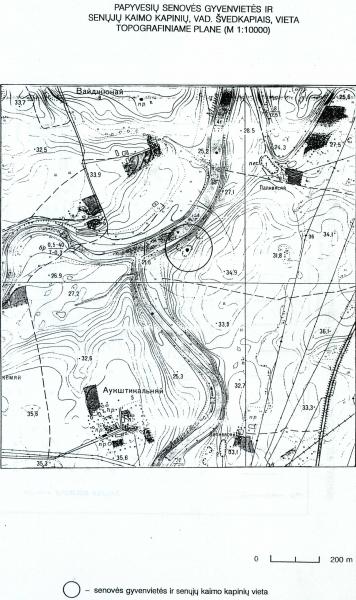
Papyvesiai old burial ground and ancient settlement
This ancient settlement with a burial ground is in the Pasvalys neighbourhoods’ eldership, Pasvalys district. It is located 1.2 km to the southwest from Papyvesiai village, 0.18 km to the north-east from the confluence of the Rivers Lėvuo and Mūša and about 1.6 kilometers to the south from the confluence of the Rivers Mūša and Pyvesa. The ancient settlement is on the dug off and touched by erosion hill, which was planted with mountain small pines. It is in a distance of about 33 m to the east from the bank of the River Mūša and exposed to about 27.5 meters above the current sea level. The persisting sandy hill occupies an area of 420 square meters. At the top of the area, there is a site by the length and width – 23 m to the north-south and 17 meters to the west-east direction. To the east from the hills there are plowed fields. In 1999, during an exploratory archaeological research there were found 532 artifacts, of which 398 are flint units, 94 are units of ceramic, 34 are biofacts and five are metal. Many artifacts were found in graves (33 ceramic units, 23 units of flint and three metal units). There is a suggestion to record the Papyvesiai burial ground and ancient village in the archaeological sites list and declare it as a unique monument of Stone Age village in Northern Lithuania.
