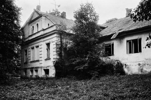
Dagilynė Manor
This manor is located in Pasvalys district, the eldership of Krinčinas. It is 8 km to northwest from Pasvalys, near the road Pasvalys–Biržai, on the right bank of the River Tatula. The manor was founded in the first half of the nineteenth century. Its former owner Otto von Ropp had 315 ha estate, which was divided in individual parcels in 1930. However, the centre of the manor remained to the owner until the Soviet nationalization. After the Second World War, the mansion was transformed into a school.
The former mansion (17 m by 12 m) is a single-storey bricked building, with a garret and a slate covered roof. There is a cellar, but wooden overlays are rotten. Next to the mansion there was a single-storey bricked building (26 m by 10 m), which walls were plastered and the roof was slate- covered. The internal walls were from unbaked bricks and there was an oven for bread baking in the basement of the building. Over one of the doors there is a bricked tile with a date 1836. Nowadays, this building is in ruins. A two-storey outbuilding was added to the northern side of the mansion where the former Basic School was. After closing the school, people were settled in those premises. The central manor house is in satisfactory condition to this day.
There are some farm buildings in the manor: one barn (13 m by 10 m), two storey building with a basement, the walls of red bricks, and the red clay tiles of the gable roof were replaced by slate. Another barn (24 m by 9 m) has only one floor, the red clay tiles of the gable roof were replaced by slate. A cattle-shed is red bricked, with a gable slate- covered roof.
Some of the manor buildings were related with domestic industry: the smokehouse of the red brick walls, which the clay tiled roof remains original, however, damaged and unrepaired. There was also a building for equipment, a forge and one more red-bricked building. The smithy (10 m by 6 m) was away, on another bank of the River Tatula, it had red-bricked walls, a gable roof from red clay tiles. It is said that the last red-bricked building was for a locomobile, which rotated a mill in one of the barns.
The former manor park is considerably devastated. Some large birches, ash-trees, oaks and nut-trees grow here. There are some black pines, Pennsylvanian ashes and a European larch. The lime paths are still delightful. In the southern edge of the park you can see the River Tatula flowing.
